Seronera airstripSerengeti national park, Tanzania

Altitude: 1600 m.a.m.s.l.
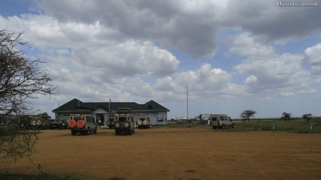
One of the airstrips located inside the Serengeti national park, about a kilometre south of the Seronera tourist information centre. At the time of writing (2017), it is the largest by size and mostly used by small regional flights, from as far as Dar es salaam, along with a few small international ones.
There also is one airport building, that serves as the lobby as well as administration offices.
What to do there?Book or board a flight to nearby regions or just an air safari. For a list of attractions that you could see in the nearby area, see the section below after map or the attractions page.
Best time to visitAnytime of the year, with the early months being better for viewing the wildebeest migration.
Location of Seronera airstripThe airstrip is located at the heart of the Serengeti national park of northern Tanzania, inside the small town of Seronera. There are quite a lot of both special and public campsites nearby, as well as a lodge, a tourist information centre, two fuel stations and a village with shops, bars and a dispensary. For more information on its location, please see the map below.How to get there?Assuming you are heading out there for a flight, then a drive from any point within the national park would get you there. It is about a 2 hour drive from both Naabi hill and Ndabaka gates.
For information about park fees and permits, please see the TANAPA website
Abbreviationsm.a.m.s.l. - metres above metric sea level
Continue reading
Popular spots