Etosha salt panEtosha National Park, Namibia

Altitude:1080 - 1090 m.a.m.s.l.
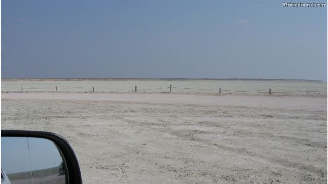
It is the largest of all salt pans in area, with a size of about 4800 square kilometers.
Gets its name from an Oshindonga word meaning 'great white place' and covers just over 20% of Etosha national park.3
Said to have been a prehistoric lake, but tectonic plate movement changed this, leaving a saline desert where almost nothing can grow. Nothing but the toughest of grasses — in some places and during the rains.
The area around it is also slightly saline, though filled with more vegetation and teaming with wildlife.
It fills up with water during the rains, though this quickly dries up once the dry season comes. Some of its water comes from seasonal rivers from the north and east.
In years with severe rainfall, the pan turns into a shallow lake about 10cm deep, and becomes a breeding ground for flamingos.
During the dry season, the ground cracks in some areas to leave hexagonal shaped mud blocks, which quickly crumble as one walks on it.
What to do thereGame viewing, from a number of lookout points near its perimeter, a pair of binoculars may come in handy
Some of these points allow you to walk onto and even drive on the pan, though only few animals ever venture onto it.
Best time to visitAny time of the year, depending on what you want to see and your budget. The rainy season of December to March are the low season with lower prices.
Location of Etosha salt panEtosha salt pan is almost entirely within Etosha national park, with the exception of the northeastern end.
It also is in northern Namibia, and there are other smaller ones nearby such as the Adamax and Natukanaoka pan.
Vegetation around it varies from Savannah and Mopane woodlands to shrublands.
How to get thereBy air or road, with a number of airstrips nearby for the first option, some of which belong to lodges and resorts.
It is about a 6 hour drive north of Namibia's capital Windhoek, most of which is tarmac, except for the park roads.
There are a number of companies offering self drive packages, as well as overland and bus tours at affordable prices. But, you could also use a private or rental car to get there, even if it is not a 4x4.
References1. By Harald Supfle - photo taken by Harald Supfle, CC BY-SA 2.5, https://commons.wikimedia.org/w/index.php?curid=496497
2. By Yathin S Krishnappa - Own work, CC BY-SA 3.0, https://commons.wikimedia.org/w/index.php?curid=22859864
3. https://en.wikipedia.org/wiki/Etosha_National_Park - accessed on 15th July, 2019
Continue reading
Popular spots