Shifting sands 2Ngorongoro conservation area, Tanzania
 Shifting sands 2 of Ngorongoro conservation area, as seen from up close (south)
 Shifting sands 2 of Ngorongoro conservation area, up close
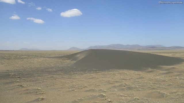
- Shifting sands 2 of Ngorongoro conservation area, view from a distance when approaching it from the larger shifting sands (south)
- Shifting sands 2 of Ngorongoro conservation area, in the distance
- Shifting sands 2 of Ngorongoro conservation area, a section of the sandy roads to it from Olduvai gorge museum
- Shifting sands 2 of Ngorongoro conservation area, looking out at the vast plains near it - a Thomson's gazelle in the distance
- Shifting sands 2 of Ngorongoro conservation area, the roads from it heading north
Altitude: 1500 m.a.m.s.l.
The smaller version of Ngorongoro's shifting sands located about a 10 minute drive north of it. A crescent shaped black dune, composed of volcanic ash from the nearby volcanic mountain - Oldoinyo Lengai, that is moving slowly westwards across the Ngorongoro plains at a rate of about 15 to 20 metres per year.
Unlike its larger sibling south, it is about 1m in height, and 6 x 6 metres in width, with the area around it being a grassland that turns green in the rainy seasons. Both dunes were created from a massive eruption at Oldoinyo Lengai over 3,000 years ago.
What to do there?See with your own eyes the large distances that the sands cover every year, along with the composition and texture of the dune's sands. When done, you could also visit other attractions in the vicinity (see section after map below).
Best time to visit?Any time of the year, especially during the wildebeest migration.
Location of Shifting sands 2The smaller shifting sands are located in the north eastern plains of Ngorongoro conservation area, and just about 4 km north of the larger shifting sands - in northern Tanzania. It takes about a half hour drive to get there from the Olduvai gorge museum. For more information on its location, please see the map below.
How to get there?By vehicle - mostly a good 4x4 to be able to get through some of the sandy roads in the area. As it is inside the conservation area, you would need to pay for the required permits before heading out here.(see the NCAA website for more info).
AbbreviationsNCAA - Ngorongoro Conservation Area Authority
m.a.m.s.l. - metres above metric sea level
Continue reading
Popular spots