Uwanja wa mbogo (buffalos glade)Arusha national park, Tanzania
 Uwanja wa mbogo (buffalo's glade) of Arusha national park, a herd of buffalos grazing on the path to Tululusia waterfalls - further up this river
 Uwanja wa mbogo (buffalo's glade) of Arusha national park, animal skulls seen on the path to it
- Uwanja wa mbogo (buffalo's glade) of Arusha national park, Ngarenanyuki river crossed in the early stages of the path to it
- Uwanja wa mbogo (buffalo's glade) of Arusha national park, 'looking back' at a bridge crossing the Ngarenanyuki river in photo 3
- Uwanja wa mbogo (buffalo's glade) of Arusha national park, 'first view' after emerging into the glade (north eastern part)
- Uwanja wa mbogo (buffalo's glade) of Arusha national park, a herd of buffaloes in the distance - a view when emerging from the path from Momela gate
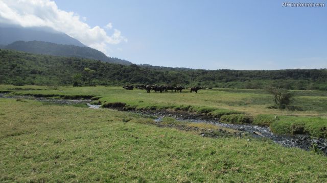
- Uwanja wa mbogo (buffalo's glade) of Arusha national park, a herd of buffaloes grazing on the field
- Uwanja wa mbogo (buffalo's glade) of Arusha national park, buffaloes (in the distance) on it with a cloud covered mount Meru in the background
- Uwanja wa mbogo (buffalo's glade) of Arusha national park, a herd of buffaloes grazing on it with mount Meru in the background
- Uwanja wa mbogo (buffalo's glade) of Arusha national park, a group of tourist walking on it to Tululusia waterfalls
- Uwanja wa mbogo (buffalo's glade) of Arusha national park, view of the southern half of it
- Uwanja wa mbogo (buffalo's glade) of Arusha national park, looking at the northern half of it with a herd of buffaloes in the distance
- Uwanja wa mbogo (buffalo's glade) of Arusha national park, giraffe grazing (in the distance) at its western end
- Uwanja wa mbogo (buffalo's glade) of Arusha national park, a group of giraffe grazing on its western end
- Uwanja wa mbogo (buffalo's glade) of Arusha national park, giraffe on the western part of it
- Uwanja wa mbogo (buffalo's glade) of Arusha national park, Tululusia waterfalls - a short distance west of it
- Uwanja wa mbogo (buffalo's glade) of Arusha national park, a view of the southern end with Meru foothills behind them
- Uwanja wa mbogo (buffalo's glade) of Arusha national park, a view from the hiking path on its southern end
Altitude: 1400 m.a.m.s.l.
A large natural glade consisting of marsh, bushes and streams that is located approximately 500 metres west of Momela gate - Arusha national park. It serves as a feeding ground for buffalos, giraffes and warthogs as well as a destination for walking safaris.
The walking safaris that go through this field include the treks up mount Meru and hikes to nearby Tululusia waterfalls.
One of the amazing things about the glades is how the buffalos and warthogs coexist, each depending on the other to ensure survival.
The Warthogs use the buffalo biomass to ward off some of its natural enemies, in return they use their good eyesight to warn the buffalos of an impending enemy threat by running while holding their tails up in the air - a phenomenon that can be observed as one walks towards the glade.
Security is not the only reason that buffalos and warthogs coexist on this field, as the buffalos tend to feed on long grass - making it shorter and more accessible to warthogs who are adapted to feeding while resting on their knees. There is yet to be a scientific reason behind this posture [1].
What to do there?Hike to the place and take a picture with the animals in the background OR take a picture of the animals themselves - nothing says you've been to the wild more than this. Just don't get too close as they are wild animals after all and always listen to what the TANAPA ranger says.
There also are several plant species in the same field that you could find including flowers such as jasmine, the fig tree and the famous acacia that giraffes love to feed on.
Best time to visit?Any time of the year, with more emphasis towards the drier season of July to February. Although the trek can still be made in the rainy season, other areas of the park may be less accessible, with the possibility of unexpected showers hindering your hike.
Location of Uwanja wa mbogo (buffalos glade)The buffalos glade is located a short distance west of the Momela gate on the north eastern part of Arusha national park. It is also on the foothills of mount Meru and is one of the first attractions that hikers to its summit get to see - provided they began hiking at the gate.
For more information on its location, please see the map below (click to start).
How to get there?The field is less than 500 metres from Momela gate, with the only means of getting there being a walking safari with an armed TANAPA ranger accompanying you. Regardless of your point of entry, you normally would be required to get to Momela gate, where they would check your permits and give you any further instructions along with a ranger who would also be your guide.
Getting to Momela gate can be done via public transport using buses heading to Momela from Arusha or nearby towns. These go through the park, stopping at the gate for checking of permits. One caveat to this method is that it may severely limit the number of places that you may visit in the park.
A better approach would be to use a private or rented car to get there, which although slightly more expensive (vehicle permit fee) would allow you to visit other parts of the park as well. The roads in the park are well maintained dirt roads, that are accessible for most days of the year.
At the time of writing (2017), other fees that may be required to be paid include a conservation fee of TSHS 10,000 (East African citizens) or USD 45 (other nationals), a walking tour fee of TSHS 5,000 or USD 20. For more information on the fees, please see the TANAPA website.
Both 4x4 and non 4x4 vehicles are allowed in the park.References1. 2017 park brochure by TANAPA
Other information from an actual visit to the grassland
Abbreviationsm.a.m.s.l. - metres above metric sea level
TANAPA - Tanzania National Parks
Continue reading
Popular spots