Longonot craterMount longonot national park, Kenya
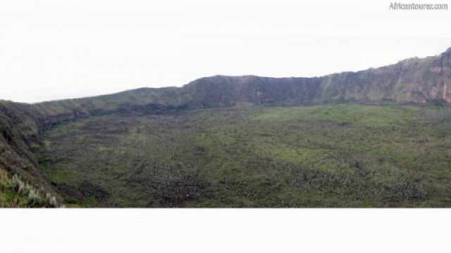
mount Longonot crater, a view from the rim 1
Altitude 2545 m.a.m.s.l. (rim)
One of the larger caldera's in Africa, and a part of mount Longonot — an extinct volcano in the rift valley.
Today, the crater floor is home to a dense forest and a thriving ecosystem that remains off limits to the outside world.
The rim however, is a popular hiking destination, with a trail going around the entire perimeter — giving bird's eye views of lake Naivasha and Hell's gate national park.
What to do thereHiking, cycling and rock climbing around the rim, bird watching, sight seeing, game viewing, picnics etc.
Or enjoy the scenic views of lake Naivasha and surrounding lands, from a higher vantage point.
Best time to visitThe dry seasons of July to December every year.
Location of Longonot craterThe caldera is a part of mount Longonot, and at the heart of mount Longonot national park.
How to get thereBy hiking or cycling from the park's main gate or Oloongonot campsite — roughly 2 hours on foot.
The both the gate and campsite can be reached by vehicle, cycling or hiking from the Nairobi - Nakuru highway.
But the journey up the mountain can only be done on foot or bicycle.
References1. By Brutere - Own work, CC0, https://commons.wikimedia.org/w/index.php?curid=12114663
Continue reading
Popular spots
