mount LolmalasinNgorongoro conservation area, Tanzania
 mount Lolmalasin of Ngorongoro conservation area, (left half) with Losirua (right half) as seen from the road to Empakaai
 mount Lolmalasin of Ngorongoro conservation area, (left) with Losirua on the right as seen from the road heading to the eastern rim of Empakaai crater
- mount Lolmalasin of Ngorongoro conservation area, on the far left with Losirua on the far right as seen from the road to the eastern rim of Empakaai
- mount Lolmalasin of Ngorongoro conservation area, (far left) with mount Losirua (far right) - view from the road heading to Empakaai's eastern rim
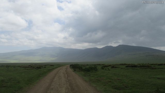
- mount Lolmalasin of Ngorongoro conservation area, (far left) with Losirua (near right) as seen from the road to Empakaai crater's eastern rim
- mount Lolmalasin of Ngorongoro conservation area, on the right as seen from the road heading to Empakaai crater's eastern rim
Altitude: 3648 m.a.m.s.l.
A gentle sided mountain located inside the Ngorongoro conservation area, that serves a hiking destination. It is located close to another mountain - Losirua with a ridge joining them to form what what looks like a single mountain range.
What to do there? Hike to its top and enjoy the views of the surrounding features of the conservation area. Hiking time is estimated to be one day, normally requiring the use of an NCAA ranger.
Best time to visitAny time of the year, with more emphasis towards the dry season of July to January each year. There may be short rains in December.
Location of mount LolmalasinMount Lolmalasin is located near the eastern border of the Ngorongoro conservation area, in the northern part of Tanzania. Both it and its neighbour Losirua are visible from the road headed to Empakaai crater. For more information on its location, please see the map below.
How to get thereVia a drive to one of the villages near it, either Olturotowas - the nearest or Nainokanoka, and hiking from there towards its top. As it is inside the Ngorongoro conservation area, you would need to pay for the required permits (see the NCAA website for more details).
AbbreviationsNCAA - Ngorongoro Conservation Area Authority
m.a.m.s.l. - metres above metric sea level
Continue reading
Day
00:00
GMT
+z
Related places
We have no related places to show you
Popular spots