mount Ol doinyo lengai ngorongoro conservation area, Tanzania
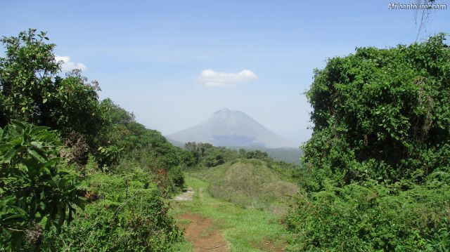
 Ol' Doinyo lengai, as seen from the eastern crater rim of Empakaai crater
 Ol' Doinyo lengai, on the far left with Kerimasi crater on the right - as seen from the eastern rim of Empakaai crater
- Ol' Doinyo lengai, through the bushes of the eastern rim of Empakaai crater
- Ol' Doinyo Lengai as seen from the north at lake Natron[3]
- Ol Doinyo lengai(far left) and a section of the rift valley and lake natron's southern end[2]
Altitude: 2962 m.a.m.s.l.
An active volcanic mountain located in the northern Arusha region of Tanzania. It is the third highest mountain in the Tanzania, with its eruptions uniquely producing natrocarbonatite lava. It's eruption in 1960 lead to geological investigations that finally confirmed that carbonatite rock is derived from magma.[1]
Its name translates to 'the mountain of God', a phrase that originates from the local Masai language, a name dubbed due to its constant activity and rumbling throughout the years. Hiking to the top of the mountain is possible, but requires explicit care and the assistance of a guide or a tours company, mainly for safety reasons. Some climbers have been known to walk down into the crater and a lot closer to the molten lava flows, however any climbing is done at your own risk.
The lava of Ol' Doinyo has a different mineral composition from that of other lava, making it erupt at relatively low temperatures of approximately 510 degrees Celcius (950 degrees Fahrenheit), a temperature so low that it appears black in colour, rather than having the red glow that is common to most lava.
Its lava is also much more fluid than common lava and often less viscous than water. However, once it has erupted, it quickly turns from black to gray in colour, resulting in a volcanic landscape is different from any other in the world[1].
Best time to visitAny time of the year, with more emphasis towards the dry season of July to December every year - when the roads are more pliable.
Location of mount Ol doinyo lengaiOl' Doinyo Lengai is located inside the Loliondo game controlled area, just a short distance north of the Ngorongoro conservation area of northern Tanzania. It also lies inside the eastern branch of the great east African rift, sharing the same volcanic system as lake Natron, lake Eyasi, Ngorongoro crater and mount Kilimanjaro.
How to get there?
Ol' Doinyo lengai is well outside the nearest city - Arusha, and far from civilization and well off the tarmac roads, making one day return trips difficult if not impossible if you intend to hike up it. Usually trips to the mountain are conducted from one of the nearby lodges or campsites in the conservation area, nearby villages or from nearby towns such as Mto wa Mbu and Karatu
There are two routes to get there, one going through the Ngorongoro conservation area up to Empakaai's eastern rim using a vehicle (or even up to Naiyobi village depending on the roads), then walking from there with the option of camping along the way.
The other route goes outside the conservation area, with a turning point heading north from Mto wa Mbu - a dirt road culminating at the mountain's eastern base.
AbbreviationsNCAA - Ngorongoro Conservation Area Authority
m.a.m.s.l. - metres above metric sea level
References
1. https://en.wikipedia.org/wiki/Ol_Doinyo_Lengai
2. By Clem23 - Own work, CC BY-SA 3.0, https://commons.wikimedia.org/w/index.php?curid=2204942
3. By Clem23 - Own work, CC BY-SA 3.0, https://commons.wikimedia.org/w/index.php?curid=2027089
Continue reading
Day
00:00
GMT
+z
Related places
We have no related places to show you
Popular spots