Mount longonot national parkwestern Kenya

Altitude: 2780 m.a.m.s.l. (rim)
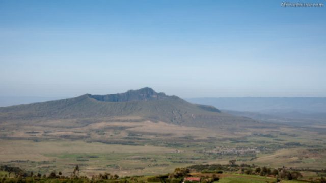
Formed around mount Longonot, a stratovolcano in the Great Rift Valley of Kenya that last last erupted in the 1860s 3.
Its name is derived from a Masai word — Oloonong’ot meaning mountain of many
spurs or steep ridges.
Animals you may see here include buffaloes, elands, lions, leopards, bush-bucks, zebra, giraffe and Grant’s gazelles.
Mount Longonot's crater is home to a forest of small trees, with its sides having small steam vents that are visible to hikers on the rim — like smoke from somebody's cooking.
What to do thereHike up to the crater rim, and around it — whether for the views, or just for fun.
Or go cycling, camping, picnics, bird-watching, game viewing, and rock climbing.
You may need a guide to make the most of your hike, as they do have some interesting stories to tell.
Best time to visitAny time of the year not in the rainy season of March to June
Location of Mount longonot national parkMount Longonot national park is southeast of lake Naivasha and can be seen from both it, and Hell's gate national park.
It is also about an hour north west of Nairobi by car.
How to get thereBy vehicle or cycling from nearby towns along the along the Old Naivasha road.
Walking is also a viable method but may take longer.
The nearest airstrip is in the town of Naivasha, less than an hour's drive north of here.
References1. By Hansueli KrapfThis file was uploaded with Commonist. - Own work: Hansueli Krapf (User Simisa (talk · contribs)), CC BY-SA 4.0, https://commons.wikimedia.org/w/index.php?curid=68797564
2. By Xiaojun Deng - Flickr: Great Rift Valley, CC BY 2.0, https://commons.wikimedia.org/w/index.php?curid=27808854
3. https://en.wikipedia.org/wiki/Mount_Longonot - accessed on 10th January, 2019
Continue reading
Popular spots