Naar engolong hillArusha, Tanzania
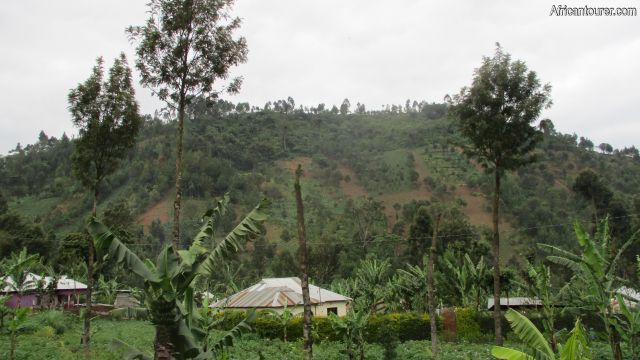
 Naar engolong hill, a view from Olgilai village on a road to Themi falls leisure park
 Naar engolong hill, one of the views available from its top - mount Meru
- Naar engolong hill, one of the views available from its top - mount Meru with its top covered in clouds
- Naar engolong hill, a small pine tree farm at its top belonging to one of Olgilai village residents
- Naar engolong hill, cultivated farms at its summit
- Naar engolong hill, views from the summit - Oldonyo Sapuk (near right) with Arusha city (far left)
- Naar engolong hill, view from the top - the top of Oldonyo Sapuk
- Naar engolong hill, view from its top - Oldonyo Sapuk (left) with mount Meru (right)
- Naar engolong hill, pine tree farm near its top with mount Meru in the distance
- Naar engolong hill, looking back at one of the trails (paths to farms) to the top near the start
- Naar engolong hill, the start of one of the many hiking trails
- Naar engolong hill, school children using the trails near the start - through potato and banana farms
- Naar engolong hill, some of the potato farms on its slopes as seen from the hiking trail
- Naar engolong hill, another section of the hiking trail to the top through local potato farms
- Naar engolong hill, potato farms (near) with pine trees (in the distance) as seen on trail to the top
- Naar engolong hill, hikers on the way to the top
- Naar engolong hill, looking back midway to the top - a steep slope downhill
- Naar engolong hill, near the top - views from the hiking trail
- Naar engolong hill, a view of neighbouring Oldonyo Sapuk from a point on the hiking trail near the top
- Naar engolong hill, Arusha city in the distance - one of the views available at the top
- Naar engolong hill, as seen from its top - a zoomed view of Arusha city
- Naar engolong hill, 'through the pine trees' - a zoomed view of the top of Oldonyo Sapuk (nearby)
- Naar engolong hill, neighbouring hills (also for hiking) Kivesi (far) and another (near) whose name is unknown
- Naar engolong hill, views from the hiking trail - Arusha city in the distance
- Naar engolong hill, views of its steep slopes as seen from the hiking trail
- Naar engolong hill, views from the top - Olgilai village (near) and Arusha city (in the distance)
- Naar engolong hill, views of its steep sided slopes from the trail with mount Meru in the distance
- Naar engolong hill Arusha, a view from the path down to Ngiresi village in the north
- Naar engolong hill Arusha, path through Ngiresi village north of the hill
- Naar engolong hill Arusha, roads through Ngiresi village in the north heading back to Themi falls
- Naar engolong hill Arusha, in the background as seen from a village north of it
- Naar engolong hill Arusha, 'on the way back to Themi falls' - border roads with park area on the right
Naar Engolong is one of the foothills of mount Meru, that is located a short distance south of it and in Arusha - Tanzania. Most of it is covered by farms belonging to people of Olgilai village, growing everything from potatoes and maize to pine and banana trees. It has red volcanic soils and the sides used to climb it are quite steep, with an angle of slope that exceeds 45 degrees in some places.
The climb to the top of it serves as one of the activities offered by Themi falls leisure park. There is no set trail as most of it is covered in farms thus the trek usually requires a guide, who normally is a local to traverse through the many farms safely and without getting lost.
At the top of it are some amazing views of the neighbouring mount Meru, the city of Arusha, Olgilai village and the Neighbouring Oldonyo Sapuk. Normal climbing times are about 1 to 2 hours, depending on the climber's level of fitness and generally no climbing skills are required but it does help to be somewhat fit and agile.
Although other tour companies may offer the climb as well, it does help to use one that is already well experienced in the area.
What to do there?Climb to the top of it for an amazing 360 view of the surrounding, best done on a clear day (check weather forecast). On your way to the top, you may get to meet some of the many villagers working on their farms, majority of whom are women, or the occasional old lady carrying something on her head, heading downhill. Despite how steep the hill is, it still is amazing to see how the locals carry firewood, buckets of water or harvested products uphill or downhill with ease. For those with an interest in agriculture, then the climb may be a chance to see how several foods are grown along with how rural farms function.
If you still have some energy left in you and enough daylight after descending from the hill, then you could try the other ones near by such as Oldonyo Sapuk and Kivesi; Or better yet, hike to the Themi waterfalls nearby (if you haven't) done that already and the other much larger one about a 30 minutes hike from the village. And when the day is done you either have the choice of camping out at Themi falls leisure park or heading back to urban Arusha.
The cost of climbing the hill is an all inclusive fee of TSHS 15,000 for Tanzanian citizens and USD 15 for foreigners; However, this fee does give you access to a full day tour of all the activities provided by the park, including the hike to the Themi waterfall - So remember to start early if you want to save.
Best time to visit?Any time other than the rainy season (march to june) as during this time the hill's sides do become quite muddy and the climb harder that usual. We recommend the July to November period as best for climbing the hill as there also is less cloud cover and thus better views. Also remember to plan the climb for a day with less cloud cover (check the weather forecast).
Location of Naar engolong hillNaar engolong hill is located next to and east of the Olgilai village, Themi waterfalls and the Themi falls leisure park itself of Arusha - Tanzania. To the west of it is Oldonyo Sapuk and the two usually cast shadows on each other at dawn and dusk, which is where the name Naar engolong comes from the local Arusha or Maasai tribe, meaning 'I feel the sun' referring to the shadow cast on it during dusk. The hill is also a short distance south of the base of mount Meru, and Arusha national park, with some of the park's trees easily visible from its top. For more information on its location, please see the map below (click to start)
How to get there?Just get to Themi falls leisure park and the guides should help get you to the hill. The park is easily reached from the Arusha - Moshi highway, with a turning point opposite the mount Meru hotel (a little east of it) heading north. The road to the park is a well maintained - all seasons dirt road, that goes up a steep hill with a left at the T junction. The park is about 5 km from the main road.
There are minibuses that traverse this same dirt road, but these do not go all the way to the park. For the sake of simplicity and safety, we recommend taking a taxi from the main road, if you do not have your own private transport, or call the park beforehand and have them arrange transport for you to and from the place.
Continue reading
Day
00:00
GMT
+z
Related places
We have no related places to show you
Popular spots